Flow
Flow
TriniTuner.com  |  Latest Event:  

Forums

2010 and 2011 Tropical weather discussion

this is how we do it.......

Moderator: 3ne2nr Mods

User avatar
NorStar2K
3NE 2NR Moderator
Posts: 1507
Joined: April 14th, 2004, 3:01 pm

Re: The official tropical weather thread: image updates on p

Postby NorStar2K » October 30th, 2010, 11:48 am

Thanks bushwakka.

User avatar
tourniquet
punchin NOS
Posts: 3344
Joined: May 10th, 2005, 2:23 pm

Re: The official tropical weather thread: image updates on p

Postby tourniquet » October 30th, 2010, 12:03 pm

.........and once again we see that many trinis are nothing more than a bunch of whiny beyotches :lol: :lol:

User avatar
White CZ4A
30 pounds of Boost
Posts: 2622
Joined: April 18th, 2003, 2:08 pm

Re: The official tropical weather thread: image updates on p

Postby White CZ4A » October 30th, 2010, 12:07 pm

Blazing sun in sando

toyolink
3NE 2NR Power Seller
Posts: 2782
Joined: May 22nd, 2010, 11:24 am

Re: The official tropical weather thread: image updates on p

Postby toyolink » October 30th, 2010, 12:12 pm

Well,well, well!
We seemed to have dodged a bullet again.I firmly believe that the south american mainland really exerts a signicant barrier these storms which come across just don't have the momentum to punch through.The problem still remains if we are really mentally and physically prepared.I based on actions yesterday am certain we are not.Preparation for rainy season starts in the dry and for the dry season in the rainy.The evacuation of POS is still a major problem also, did anyone look at the faces of the kids who had to travel yesterday.Specials plans to move children must be institutionalised and communicated.I was tempted to pick-up every child who could have fit in my truck but just couldn't because of law and load in tray.

User avatar
*$kїđž!™
TriniTuner 24-7
Posts: 11111
Joined: December 25th, 2006, 2:58 pm
Location: VIP SECTION

Re: The official tropical weather thread: image updates on p

Postby *$kїđž!™ » October 30th, 2010, 12:19 pm

Hot sun in chaguanas man....Once again ppl panic for nuthin and the trini weather forecasters got it wrong again.....as usual......Blessed is Trini.....at least in terms of the weather....

Heard some public places like NALIS still closing early today because of the impending storm......

User avatar
apple
Trinituner Peong
Posts: 425
Joined: November 18th, 2008, 7:16 pm
Location: San Fernando

Re: The official tropical weather thread: image updates on p

Postby apple » October 30th, 2010, 12:26 pm

sometimes I does just wanna cuss up ignorant people yes!!

User avatar
zitanos
Street 2NR
Posts: 67
Joined: July 11th, 2005, 3:11 pm

Re: The official tropical weather thread: image updates on p

Postby zitanos » October 30th, 2010, 12:29 pm

Latest update is out: http://metoffice.gov.tt/watches/article.aspx?id=8347


Warning#

Date: Saturday 30th of October 2010
ISSUED AT:12:13PM

TOMAS NOW A HURRICANE: ADVISORY 8
TROPICAL STORM WARNING FOR TRINIDAD AND TOBAGO,
GRENADA AND ITS DEPENDENCIES
Issued by the Trinidad and Tobago Meteorological
Service

A Tropical Storm Warning remains in effect for
Trinidad, Tobago, Grenada and its dependencies.
A Tropical Storm Warning means that Trinidad and
Tobago, Grenada and its dependencies can expect
Tropical Storm conditions within 36 hours.
At 11:00am today, Saturday, October 30, 2010,
Tomas was upgraded to a hurricane and its centre
was located near 13.3ºN latitude 60.7ºW
longitude or about 55 kilometers east of St.
Vincent.


Hurricane Tomas is moving to the west-northwest at
about 24km/hr. This general motion is expected to
continue over the next 24 to 48 hours during
which it is forecast to intensify further with a
decrease in forward speed as environmental
conditions continue to be conducive for
strengthening.
Maximum sustained winds are near 120km/hr with
higher gusts. Tropical Storm force winds extend
outwards up to 280 km from the centre. Minimum
central pressure is 993mb.
Tobago, Grenada and it dependencies remain within
the storm environment although major convective
activity is north and east of these islands.
Northern Trinidad is also within the environment
of Tomas and feeder band activity poses a serious
threat as this can produce storm strength
effects..
Further, the slow westward movement of Tomas
could bring the southernmost periphery of its
cloud envelope over some areas of Trinidad later
today.


Hurricane Tomas therefore still poses a real and
imminent threat as long as it remains in our
island’s vicinity rotating, gathering strength
and slowly moving.
Tomas can produce total rainfall accumulations in
excess of 25mm across Central and Southern
Trinidad in some locations and possibly in
excess of 75 mm over Tobago, Northern Trinidad,
Grenada and its dependencies.. Sea conditions are
also anticipated to become very disturbed and
adversely affect marine and coastline interests.
Citizens and all concerned are advised to closely
follow the directions and advise of their Disaster
Emergency Managers at this time. Adopt all
necessary measures to preserve life and
property.
Repeating Hurricane Tomas 11:00am position:
13.3ºN latitude 60.7ºW longitude or about 55
kilometers east of St.Vincent.
The Trinidad and Tobago Meteorological Services
will issue another bulletin at 3:00pm later
today. Please refer to the Trinidad and Tobago
Meteorological Services website,
www.metoffice.gov.tt, for further details and
stay tuned to your regular broadcast media.

User avatar
cornfused
30 pounds of Boost
Posts: 2547
Joined: May 1st, 2003, 9:09 am
Location: utilizing FIFA rules in small goal

Re: The official tropical weather thread: image updates on p

Postby cornfused » October 30th, 2010, 12:33 pm

Thanks to Hook and all those who positively contributed to this information in this thread , those you continue to think that mother nature is a joke ask your friends in Barbados how it was and still is , that is when you can get into contact with them. As said before this is a dynamic system and those thinking its a joke will come to the realization soon enough that its not , the chaos that reigned on our roads and the indecisiveness but those in authority , we need a mass transit system to get person out of POS in times like these the already inefficient passenger vehicular system just does not cut it and the PBR has its own traffic issues , the foreshore and wrighston road were a mess, foresight was never a strong point for our policy makers or local population, but anything resembling a nation disaster management plan needs to be done and done now

User avatar
NorStar2K
3NE 2NR Moderator
Posts: 1507
Joined: April 14th, 2004, 3:01 pm

Re: The official tropical weather thread: image updates on p

Postby NorStar2K » October 30th, 2010, 2:33 pm

cornfused wrote:Thanks to Hook and all those who positively contributed to this information in this thread , those you continue to think that mother nature is a joke ask your friends in Barbados how it was and still is , that is when you can get into contact with them. As said before this is a dynamic system and those thinking its a joke will come to the realization soon enough that its not , the chaos that reigned on our roads and the indecisiveness but those in authority , we need a mass transit system to get person out of POS in times like these the already inefficient passenger vehicular system just does not cut it and the PBR has its own traffic issues , the foreshore and wrighston road were a mess, foresight was never a strong point for our policy makers or local population, but anything resembling a nation disaster management plan needs to be done and done now

Now take what cornfused said and add a Cat.1 Hurricane with sustained winds of 119–153km/h and imagine for a moment what would have happened.

Remember TS Bret (1993)? Bret peak as a 60 mph (95 km/h) tropical storm as it neared Trinidad. TS Bret then took an extremely southerly course through the Caribbean, passing over the north coasts of Colombia and Venezuela. Bret killed 173 in Venezuela. That could easily have been us.

We've gotten complacent. All we've had thus far was luck. It could still happen. Are we prepared? Well all know than answer to that...................

redmanjp
TriniTuner 24-7
Posts: 17656
Joined: September 22nd, 2009, 11:01 pm
Contact:

Re: The official tropical weather thread: image updates on p

Postby redmanjp » October 30th, 2010, 2:42 pm

Hook is d warning off for Trinidad or what?

http://metoffice.gov.tt/watches/article.aspx?id=8347
Warning#

Date: Saturday 30th of October 2010
ISSUED AT:12:13PM

TOMAS NOW A HURRICANE: ADVISORY 8
TROPICAL STORM WARNING FOR TRINIDAD AND TOBAGO,
GRENADA AND ITS DEPENDENCIES
Issued by the Trinidad and Tobago Meteorological
Service

A Tropical Storm Warning remains in effect for
Trinidad, Tobago, Grenada and its dependencies.
A Tropical Storm Warning means that Trinidad and
Tobago, Grenada and its dependencies can expect
Tropical Storm conditions within 36 hours.


BUT AT 2PM NHC saying

http://www.nhc.noaa.gov/text/refresh/MIATCPAT1+shtml/301737.shtml
WATCHES AND WARNINGS
--------------------
CHANGES WITH THIS ADVISORY...

THE GOVERNMENT OF TRINIDAD AND TOBAGO HAS DISCONTINUED THE TROPICAL
STORM WARNING FOR TRINIDAD.


SUMMARY OF WATCHES AND WARNINGS IN EFFECT...

A HURRICANE WARNING IS IN EFFECT FOR...
* ST. VINCENT AND THE GRENADINES
* ST. LUCIA
* MARTINIQUE

A TROPICAL STORM WARNING IS IN EFFECT FOR...
* BARBADOS
* DOMINICA
* TOBAGO
* GRENADA

User avatar
NorStar2K
3NE 2NR Moderator
Posts: 1507
Joined: April 14th, 2004, 3:01 pm

Re: The official tropical weather thread: image updates on p

Postby NorStar2K » October 30th, 2010, 3:04 pm

Valid from the 1500Hrs. Bulletin.

Tropical Storm Warning DISCONTINUED for Trinidad

toyolink
3NE 2NR Power Seller
Posts: 2782
Joined: May 22nd, 2010, 11:24 am

Re: The official tropical weather thread: image updates on p

Postby toyolink » October 30th, 2010, 3:23 pm

I as a tot experienced FLORA in Tobago and to this day i can recall the some 6 hour of horror before my system as a child shut me down and i fell asleep.I hope never to have to live thru something like that again.People this is just not talk but the noise,the vibration,the ripping up of vegetation and property will turn anybody into a believer that we can be visited by hell on earth.A hurricane warning must be taken seriously and further even before that time comes ensure where you live could take some real jamming invest in property maintenance before hand.

goalpost
punchin NOS
Posts: 2954
Joined: June 24th, 2010, 8:18 am
Location: South by night, North by day

Re: The official tropical weather thread: image updates on p

Postby goalpost » October 30th, 2010, 3:40 pm

well we dodged a bullet yet again.

thanks to Hook and others for their timely inputs and data on this thread.

Not a drop of rain in sando 8-)

redmanjp
TriniTuner 24-7
Posts: 17656
Joined: September 22nd, 2009, 11:01 pm
Contact:

Re: The official tropical weather thread: image updates on p

Postby redmanjp » October 30th, 2010, 4:13 pm

norstar2k wrote:Valid from the 1500Hrs. Bulletin.

Tropical Storm Warning DISCONTINUED for Trinidad, BUT NOT Tobago.


fixed

Warning#

Date: Saturday 30th of October 2010
ISSUED AT:03:22PM

HURRICANE TOMAS : ADVISORY 9
TROPICAL STORM WARNING FOR TOBAGO, GRENADA AND
ITS DEPENDENCIES
TROPICAL STORM WARNING LIFTED FOR TRINIDAD
Issued by the Trinidad and Tobago Meteorological
Service

A Tropical Storm Warning remains in effect for
Tobago and Grenada and its dependencies.
Tropical Storm Warning for Trinidad is lifted.
A Tropical Storm Warning means that Tobago and
Grenada and its dependencies can expect Tropical
Storm conditions within 36 hours.

User avatar
NorStar2K
3NE 2NR Moderator
Posts: 1507
Joined: April 14th, 2004, 3:01 pm

Re: The official tropical weather thread: image updates on p

Postby NorStar2K » October 30th, 2010, 4:18 pm

Oops. Sorry. That's correct redmanjp. Long day in the EOC.

User avatar
zcarz
3ne2nr Toppa Toppa
Posts: 5124
Joined: August 26th, 2009, 12:51 am
Location: United Kingdom

Re: The official tropical weather thread: image updates on p

Postby zcarz » October 30th, 2010, 5:24 pm

Thanks a lot hook for keeping us updated. Was appreciated greatly!

User avatar
cinco
TriniTuner 24-7
Posts: 18211
Joined: January 6th, 2006, 3:21 pm
Location: Does this rag smell like chloroform to you?
Contact:

Re: The official tropical weather thread: image updates on p

Postby cinco » October 30th, 2010, 6:49 pm

thanks for the input fellas
our own met insiders

redmanjp
TriniTuner 24-7
Posts: 17656
Joined: September 22nd, 2009, 11:01 pm
Contact:

Re: The official tropical weather thread: image updates on p

Postby redmanjp » October 30th, 2010, 6:54 pm

ah think some a dem rain bands might hit us tonight

& btw, max sustained winds are now 90mph

Image

M_2NR
not Admin
Posts: 7247
Joined: December 18th, 2008, 9:46 pm

Re: The official tropical weather thread: image updates on p

Postby M_2NR » October 30th, 2010, 7:33 pm

well piarco flights in a mess. BA flight to Gatwick cancelled... and a couple others to jfk, etc. St. Lucia in a mess apparently as well. The airport roof got blown off (reports online) and it's flooded..

Also i am not sure if this was posted before but check this flash site out..

http://www.stormpulse.com/fullscreen/current

User avatar
brickman
18 pounds of Boost
Posts: 2343
Joined: February 2nd, 2010, 10:08 am
Location: In a happy place

Re: The official tropical weather thread: image updates on p

Postby brickman » October 30th, 2010, 7:43 pm

That feeder band east of us not looking nice.

SRASC
3NE 2NR Moderator
Posts: 3272
Joined: January 13th, 2008, 10:53 am

Re: The official tropical weather thread: image updates on p

Postby SRASC » October 30th, 2010, 7:46 pm

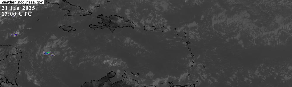
brickman wrote:That feeder band east of us not looking nice.


x2

Thought this was interesting

Image

The paths of all the recorded category 5 Atlantic hurricanes.

User avatar
searchingone
I LUV THIS PLACE
Posts: 1089
Joined: September 2nd, 2010, 9:41 am

Re: The official tropical weather thread: image updates on p

Postby searchingone » October 30th, 2010, 8:02 pm

^wow....all of which missed us by just a few millimeters :shock: ....figuratively speaking..

redmanjp
TriniTuner 24-7
Posts: 17656
Joined: September 22nd, 2009, 11:01 pm
Contact:

Re: The official tropical weather thread: image updates on p

Postby redmanjp » October 30th, 2010, 9:25 pm

thought i saw some lightning in the Southern sky a lil earlier

SRASC
3NE 2NR Moderator
Posts: 3272
Joined: January 13th, 2008, 10:53 am

Re: The official tropical weather thread: image updates on p

Postby SRASC » October 30th, 2010, 9:36 pm

my brother said the same thing earlier.

User avatar
todd61
Chronic TriniTuner
Posts: 658
Joined: March 9th, 2009, 8:43 pm
Contact:

Re: The official tropical weather thread: image updates on p

Postby todd61 » October 30th, 2010, 10:01 pm

redmanjp wrote:thought i saw some lightning in the Southern sky a lil earlier


Yup saw it to about 20 mins ago and a lot 2

redmanjp
TriniTuner 24-7
Posts: 17656
Joined: September 22nd, 2009, 11:01 pm
Contact:

Re: The official tropical weather thread: image updates on p

Postby redmanjp » October 30th, 2010, 10:15 pm

some rain is possible once the storm continues in the same direction

Image

User avatar
apple
Trinituner Peong
Posts: 425
Joined: November 18th, 2008, 7:16 pm
Location: San Fernando

Re: The official tropical weather thread: image updates on p

Postby apple » October 30th, 2010, 10:29 pm

little flashes in the sky in La Romain...rain?

:)

User avatar
streetbeastINC.
punchin NOS
Posts: 3607
Joined: April 17th, 2003, 11:48 pm
Contact:

Re: The official tropical weather thread: image updates on p

Postby streetbeastINC. » October 30th, 2010, 10:39 pm

feeder looking viscious

User avatar
streetbeastINC.
punchin NOS
Posts: 3607
Joined: April 17th, 2003, 11:48 pm
Contact:

Re: The official tropical weather thread: image updates on p

Postby streetbeastINC. » October 30th, 2010, 10:45 pm

anyone in tobago? how is the weather there

redmanjp
TriniTuner 24-7
Posts: 17656
Joined: September 22nd, 2009, 11:01 pm
Contact:

Re: The official tropical weather thread: image updates on p

Postby redmanjp » October 30th, 2010, 10:56 pm

doh know how to embed flash here (somebody could show me) but if you look at this link you will see the clouds coming closer to us from the east

http://www.ssd.noaa.gov/goes/flt/t2/flash-vis.html

wait- what do the red & white colours in this pic mean- epic rain & flood? :shock:

Image

Advertisement

Return to “Ole talk and more Ole talk”

Who is online

Users browsing this forum: Bing [Bot], pugboy and 105 guests