Postby TriP » October 18th, 2017, 11:48 pm
11:00PM Update – Third Round of Moderate to Heavy Showers expected after Midnight. Flash & Riverine Flooding likely to Persist. Gusty Winds Possible.
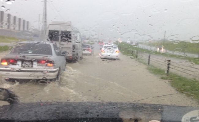
As of the latest radar imagery, most of South and Central Trinidad is currently experiencing a brief respite from persistent moderate to heavy showers that triggered widespread flooding across Trinidad currently.
Another round of widespread moderate to heavy showers will be moving onshore Trinidad from the East and South after midnight These showers may become heavy and have embedded thunderstorms which may produce wind gusts in excess of 55 KM/H. Any rainfall will likely exacerbate already receding flash flooding across the country.
Most rivers are at their threshold levels. Coupled with high tide later tonight which is expected to be a higher than normal tide due to the spring tides with additional rainfall, the possibility of major rivers overtopping their banks is real and imminent. Residents living in flood prone areas should prepare for the likelihood of additional flooding tonight through tomorrow.
Compounding on the flooding threat, a low level jet (a ribbon of strong winds at low levels of the atmosphere) in addition to a trade wind surge is expected to cause gusty winds in the presence of heavy shower and thunderstorm activity over the islands tonight into tomorrow. These gusts may exceed 55 KM/H and will be capable of bringing down trees and utility poles due to saturated soils