TriniTuner.com | Latest Event:


Moderator: 3ne2nr Mods


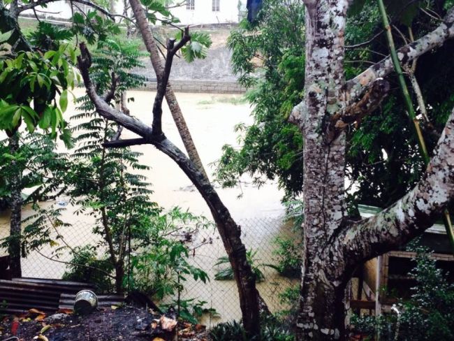
The Trinidad and Tobago Meteorological Service issues Riverine Flood Alert The Trinidad and Tobago Meteorological Service has issued a riverine flood alert for Trinidad, in light of the most recent rainfall event associated with the Inter Tropical Convergence Zone (ITCZ).
Reports indicate that water levels in the Caroni Basin are significantly high and may reach threshold levels because of runoff from the current and expected continued rainfall activity. Although water levels in the Primary Caroni River remain contained at this time, there is likely to be a gradual increase.
Meteorological Forecasts indicate further rainfall activity is expected over the next 12-24 hours with rainfall accumulation anticipated to be between 20-50 millimetres in some areas. Given the additional rainfall predicted for Trinidad and Tobago and the occurrence of high tides at 11:30 a.m. today, the possibility of river overtopping is real and imminent.
As opposed to street/flash flooding, riverine flooding can be more extensive and prolonged. The ODPM, as the National Disaster Office is currently monitoring the situation along with the Diego Martin Municipal Corporation and has alerted all first responder agencies so that assistance can be rendered to affected persons.
Citizens are therefore urged to remain vigilant and cautious and those affected are asked to contact the ODPM’s customer care centre at 511. Citizens are reminded of the following flood safety tips: • Elevate valuables and place important documents in sealed containers or bags • Do not walk / drive through flood waters • Do not touch electrical equipment if you are wet or standing in water TRINIDAD AND TOBAGO IS NOT UNDER ANY TROPICAL STORM THREAT, WATCH OR WARNING

Return to “Ole talk and more Ole talk”
Users browsing this forum: No registered users and 59 guests


